Bike & Boat archipelago route for cyclists
NOTE: Bike & Boat is available only during summer (1.7.-3.8.2025).
The Bike & Boat archipelago route for cyclists allows you to cycle part of the beautiful Espoo's Waterfront Walkway and return by public boat!
The harbors where you can start or end a cruise are Otaniemi, Nokkala, or Kivenlahti. Approximately 20 bike places are on board the archipelago boats. Cyclists are a priority, but other visitors are welcome as well. The distance covered by bike is at its longest, around 30 kilometers, when you cycle along Espoo's Waterfront Walkway between Otaniemi and Kivenlahti harbours. If you choose Nokkala Harbor as your other destination, the distance cycled is about half of that. That gives you two expeditions, which you could do on two different days.
Archipelago Boat Sections
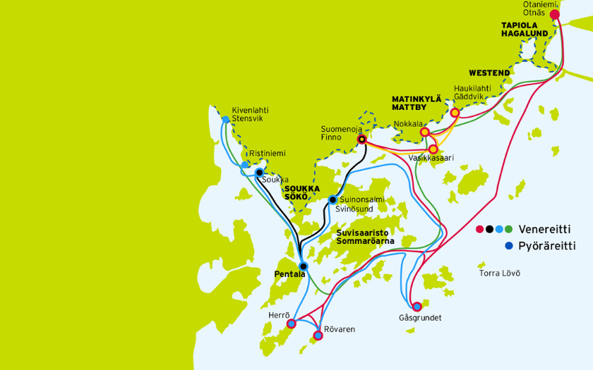
Route stops: Otaniemi - Nokkala - Kivenlahti - Nokkala - Otaniemi
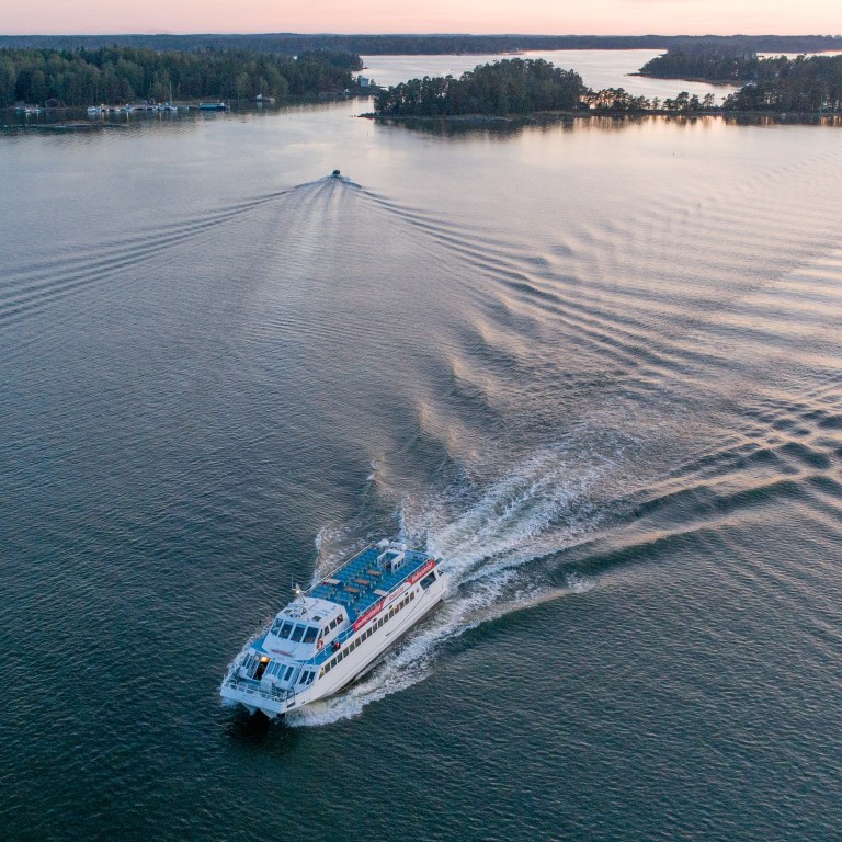
The route is operated by m/s Merisaukko, Aava Lines Oy, tel. +358 41 310 5577.
The boat accommodates 20 bikes and 20 passengers. Bikes are transported in racks. Cyclists are the priority, but other passengers are welcomed as well.
Timetable:
1.7.2025 - 3.8.2025 on Tuesdays, Wednesdays, Thursdays, Fridays, Saturdays, Sundays
Note: The boats do not run on Mondays. The number of passengers and the weather conditions can affect the timetable. The HSL Travel Card is not valid for scheduled archipelago boats.
Parking & Services in harbours
- There are approximately 150 parking spots
- The nearest bus stop is located 400 m away
- Café & Restaurants nearby: Bistro Ranta (Radisson Blu Hotel)
- There are approximately 100 parking spots
- The nearest bus stop is located 650 m away
- Café & Restaurants in the area: Nokkalan Majakka; Café Merenneito
- There are approximately 30 parking spots
- The nearest bus stop is located 300 m away
- Café & Restaurants nearby: Restaurant Marine
Boat departures
| Otaniemi | Nokkala (Matinkylä) | Kivenlahti |
|---|---|---|
| 10:00 → | 10:40 → | 11:50 |
| 13:50 | ← 13:10 | ← 12:00 |
| 14:00 → | 14:40 → | 15:50 |
| 18:00 (arrival) | ← 17:10 | ← 16:00 |
Pricing
- adult with bike 10€ / one-way ticket
- children aged 7-17 years old and special groups 7€ / one-way ticket
- children under 7 years old travel free of charge with an adult

CYCLING SECTIONS
- The archipelago boat journey between Otaniemi and Nokkala takes approximately 35 minutes. The boat travels close to the coast.
- The archipelago boat journey between Nokkala and Kivenlahti takes approximately 1 hour and travels around the maritime district of the Suvisaaristo area.
We recommend cycling at a moderate speed because the Waterfront Walkway is very popular among locals and tourists. You should avoid cycling too abreast when traveling in a group – the route is narrow in places. Please exercise caution, particularly when close to the harbor basins and in tight turnings where visibility is poor.
You will find lovely summer cafés, ice cream stands, and restaurants along the route – and you can even book a sauna. And if you decide to stay longer, there are several hotels to choose from. So, make sure you have plenty of time to enjoy the route!
Be charmed by all the enchanting nature attractions – rocks, half-hidden sandy beaches, reeds, and marine archipelago landscapes. Espoo’s Waterfront Walkway is surrounded by splendid villas and gardens, while the beautiful modern districts thrill with their fantastic architectural solutions highlighting the water elements all around. White sailing boats rocking in the wind and the calls of seagulls allow your mind to rest in the leisurely atmosphere of the seaside.
Cafés filled with happy, chatty people enjoying the summer and the sea breeze. Ice cream stands to serve treats to the passers-by.
Explore Espoo Waterfront Walkway
- Otaniemi – Nokkala 13.5 km (via Otsonlahti 2.6 km)
- Nokkala – Kivenlahti 17 km (via Suomenoja bird basins 1.8 km)
- Otaniemi – Kivenlahti 30.5 km (via Suomenoja bird basins and Otsonlahti)
Note: You can shorten your route by bypassing the sections in brackets.
The route is signposted with green ribbons and signposts for the Espoo Waterfront Walkway – but be on the lookout so you don’t miss a turning.
NAVIGATING ALONG THE ROUTE
You can follow the signposts or download a GPX file for a smart device to help you navigate or use the applications below:
Link Trailmap (free of charge)
Link RidewithGps (chargeable)

Get to know Bike & Boat cycling route via Komoot
Hero Image: Mika Viitanen


